
Future Events
Red Bluff CA Rendezvous 2025: Jedidiah Smith 1828, Buenaventura to the Pacific
As mentioned in the Fall 2024 Castor Canadensis, the Jedediah Smith Society (JSS) is excited to announce details regarding the April 2025 Red Bluff CA Rendezvous. The Rendezvous is scheduled for the weekend of April 26th and the 27th. The host hotel is the Holiday Inn Express in Red Bluff, hotel details included below. JSS member Jim OCallaghan is leading the Rendezvous event with assistance from Richard Cimino and Joe Molter. The field trip locations include Ide Adobe CA State Park, Jed’s Overlook, and Jed’s route from the Sacramento River to the Trinity River.
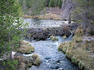
The Rendezvous commences with Saturday’s field trip departing from the host hotel parking lot at 1pm. The first stop is a brief visit to nearby Ide Adobe Park. The park memorializes California pioneer William Ide, captain of the Bear Flag Revolt and the only president of the California Republic, June to July 1846. Next, the group proceeds to a Bureau of Land Management (BLM) trailhead about five miles east of Red Bluff. The trail leads to BLM kiosk “Jed’s Overlook” highlighting Smith’s departure from the Buenaventura/Sacramento River. The trail is approximately 3.0 miles round trip, rated as moderate with little elevation gain. However, the trail is rough and rocky in certain areas requiring hiking boots and hiking poles if desired. A leisurely hike with ample time at the kiosk will take about 3 hours. BLM Map & Guides will be available for attendees. While at the kiosk, Joe Molter will provide an overview of the site. Participants are encouraged to ask questions and/or have a brief discussion.
After returning to Red Bluff between 4 and 5pm and with a bit of down time, JSS invites all Rendezvous attendees to an early (exact time TBA) Saturday evening “social” at the host hotel or a local restaurant. Location of the social will be determined by the final attendee count. If held at the host hotel, JSS will provide light snack food and non-alcoholic beverages. The hotel does allow attendees to “BYOB” i.e. bring your own libation should you desire.
Sunday’s field trip will be a vehicular tour of Jed Smith’s route from Red Bluff to the south fork of the Trinity River at Hyampom CA. (JSS/Rich Cimino is planning to provide a passenger van for trip attendees/details TBA) The roadway generally follows Smith’s west/northwest route to the Trinity River. The road trip will include a few stops at notable locations to point out specific route details. After visiting the Trinity River location, upon return the group can stop in Hayfork for lunch. (Various lunch options included below)
The Rendezvous will conclude upon return to the host hotel with any closing comments/discussion.
Hotel:
Holiday Inn Express
Reservations: 888 HOLIDAY (1 888 465 4329)
Front desk: 530-5281600
2810 Main Street Red Bluff, California 96080 United States
Check-in: 3:00 PM
Check-out: 11:00 AM
Hayfork Lunch/Dining Options:
Casa De Castellanos
7130 CA-3, Hayfork, CA 96041
Hours:
Open 11:00 AM ⋅ Closes 7:00 PM
Phone: (530) 628-5309
Hayfork Hotel
7230 CA-3, Hayfork, CA 96041
Hours:
Open 10:00 AM ⋅ Closes 11:45 PM
Phone: 530-628-5337
Cali Jay’s BBQ
Hours:
Open 12:00 PM – Closes 8:00 PM
91 Trinity St., Hayfork CA 96041
Phone: 530-628-4448
Southern California Rendezvous 2026
proposed by Art Hurley
This Rendezvous envisions visiting the monuments / locations mentioned in our “Jedediah Smith And His Monuments” book between Bakersfield and Mission San Gabriel Archangel in the LA basin. It can be done in reverse in an easy two days. To my knowledge there is no marker or monument in the area of the old Pueblo of Los Angeles ( Olivera Street Downtown), but the Avila house exists there and was visited by Smith.
Route Description: San Gabriel to Bakersfield-2 days
Start: 8am breakfast at hotel near the mission, followed by a half hour discussion laying out the background of his desire to investigate California, and a description of our route and the two JSS visits to the mission and to Southern California in general.
- Depart after the intro for Mission San Gabriel: Recap his experiences while there, and the reception of his party by Spanish authorities. Time estimate there. (30 min)
- Depart the mission for (30 min) drive to the San Dimas City Hall with monument on grounds. Discuss the JS camp at Mud Springs. Maybe drive 2 minutes south for a drive by of the Mud springs site- Google earth shows no parking there, but a small marker of the camping site. Time estimate at sites. (20 min)
- Depart San Dimas for (20 min) drive to Upland where there is the westernmost “Madonna of the Trail” statue along the National Old Trail from Maryland to California, which has a base panel referring to JS and band being the first Americans to enter California over land, Nov. 1826. Visit the monument and have lunch in the shopping center nearby. Depart after lunch for Upland for (35 min) drive to Colton.
- Arrive at 601 Hunts lane where there is a marker in the grounds of House Grain Company. This is the site of Fort Benson and the ancient Indian Village of Jumbo. Here was the first stock farm in the valley where Jedediah and band camped Nov. 1826, and again 1827. Time estimate for visit. (15 min)
- Depart Colton for the @ 15 min. drive to the San Bernardino County Courthouse to visit the JS monument at NE corner of grounds. Time estimate here. (15 min)
- Depart San Bernardino for the (45 min) drive to Hespereia Lake park “Pathfinder of the Southern Sierra” monument. Drive via I215/ Hwy 173. This monument marks the northern vicinity of the Old Indian Trail across the mountains to San Bernardino, used by JS in 1826 and 1827.
Continuing to Bakersfield we might take in the Mojave River Crossing monument in N Victorville enroute to Bakersfield. I have questions about JS using this crossing… The exact route to Bakersfield taken by JS is not known. I expect he was following a known Indian trail, so maybe the local guys have a good idea.
My vote would probably be to proceed from the Mojave Crossing monument to Willow Springs via E Ave. East, time. (1 1/2 hours) From Willow Springs via the Tehachapi -Willow Springs Rd. over Oak Creek Pass (Fremont’s route), time from Willow Springs to Tehachapi. (30 min) and to Bakersfield another. (45 min)
Another option is a route from Mojave Crossing that follows the North foothills of the mountains:
To Palmdale via south Hwy. 395, west Hwy. 13, and Hwy. (1 hour)
Palmdale to Willow Springs via Hwy. 14 and West Ave. D time. (40 min)
Willow Springs – Tehachapi via Willow Springs Tehachapi Rd. time. (30 min)
Further to Bakersfield via Hwy. 58, time. (45 min)
I don’t know the exact location of our Bakersfield monument!
I haven’t looked for hotel information, it will depend on which direction we proceed in.